Silver and Stone: Glaciers of Alsek Country
April 6, 2019
By Dove Henry
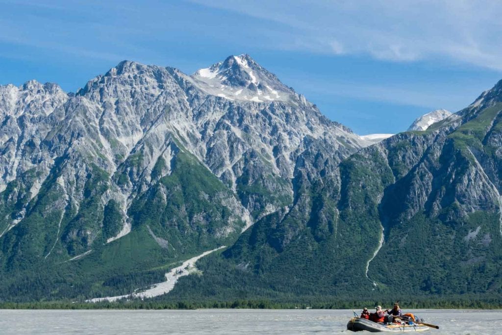
Only the ghosts of glaciers remain in most of the American countryside. Their mythology is told by the contours of the land—a rounded mountain here, a U-shaped valley there, terrestrial shapes haunted by the specters of ancient ice. But where the Alsek River flows through the Yukon, British Columbia, and southeast Alaska, glaciers are still very much alive. They are enormous, slow-growing and shrinking creatures; you can hear them bowing and creaking, shuddering, violently ratcheting, every sound magnified in the huge emptiness of the far north. Both the Alsek and Tatshenshini rivers belong to this northern landscape, so formidable and unfamiliar it is almost dreamlike—a strange, cartoonish dream that occurs right as you enter sleep, where everything is large enough to alter your very perception of distance. It is a landscape of an altogether different scale and character. It is a landscape of water and ice in myriad forms, where the cold, clear air and luminous northern light grant extraordinary clarity to the edges of everything.
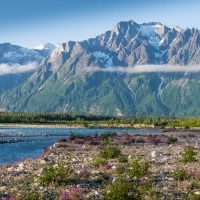
As a geologic force, the rivers here cannot be disentangled from the glaciers themselves. They are just another manifestation of ice, coursing through the earthly debris left behind by other, older ice. A trip down the upper Alsek or its tributary the Tatshenshini will take you through the various stages of a glacier’s life, from immense, frozen monolith to milky, silt-filled meltwater. The Alsek’s braided channels are fed by the glaciers of the Icefield Range, which reach down from the mountains into the expansive valley like fingers, a tributary of meltwater extending from each fingertip. They are relics from another version of the earth rendered in ice and silence, situating travelers in this landscape in a liminal timespace somewhere between the last Ice Age and the familiar, temperate present. Because the glaciers of the Icefield Range constitute the largest non-polar ice cap on the planet, the landscape is also something of a spatial hybrid, containing elements of both the boreal and arctic worlds. Riverbanks swathed in Alaskan wildflowers border some stretches of water, but around the bend, the fuchsia blooms of river beauty and spatter of Indian paintbrush are swapped for discordant gravel and ice; new springtime life pressing up against something older, something less sentient. We usually move forward through the days, months, and years in a linear fashion, but boaters borne along by the currents of water on this land will instead find themselves suspended, time circulating around them, from the Pleistocene to the present and back again.
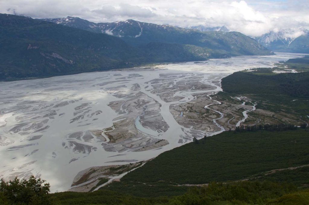
Where the Dezadeash comes to confluence with the Kaskauwalsh, the Alsek begins as a braided river: a tangle of channels that continually divide and recombine as they flow around shifting islands of glacial sediment. This is the shape a young glacial river takes, when the volume of meltwater is still high, not yet having consolidated into one main channel. The current is swift here. The water is silvery with silt so fine it hangs suspended in the water, too diminutive to ever settle. It takes ages for this silt to materialize from rock, ground down by the tremendous force of ice against earth into a substance so fine it is beyond sand, beyond even dust. Below the silt and water, along the bottom of the channels, rocks as big as boulders and small as gravel tumble and bump against each other, carried along by the current. You can hear the faint vibration of it all amplified through the rubber of the boat, a muted, constant whisper, occasionally punctuated by the rumble of larger boulders displaced by more powerful hydraulics. Hike up from the Alsek, into the glacial valley, and you will find strikingly clear lakes and ponds in hollows left by the receding ice. It’s as if a giant jewel had melted, leaving brilliant pools of precious liquid in its wake, sapphires studding the gray plains of metamorphic rock. These ponds are glassy and still, without inlets or outlets, so the sun warms them to a temperature comfortable enough to swim in on a hot summer day. Ensembles of chattering swallows swirl above the standing water, moving together in that uncanny way groups of animals do sometimes, as if they are a single organism.
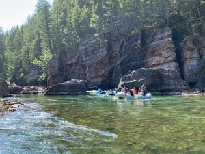
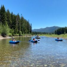
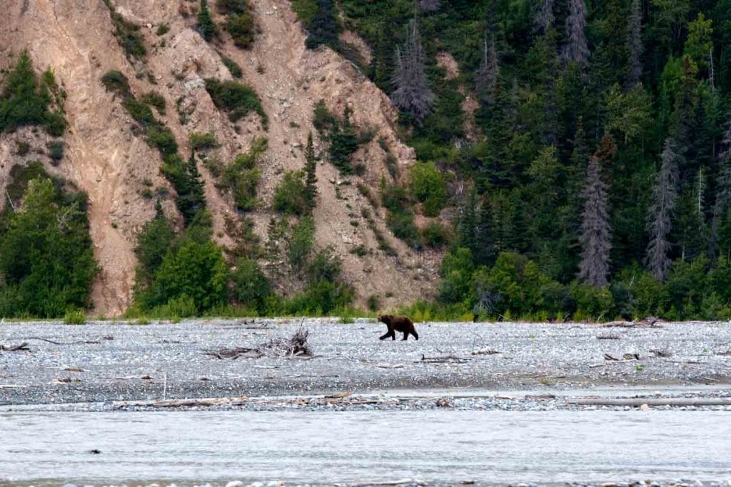
Much of the country the Tatshensheni flows through—particularly its first stretches—is rich with vegetation compared to the vast, treeless glacial valley of the upper Alsek. The river itself is smaller, tighter, and more technical, with boulder-garden-style rapids not unlike the Middle Fork of the Salmon. The landscape is in a later stage of glaciation; what were once braids of meltwater, little fledgling rivers, have merged into one main channel flanked by greenery. Time, wind, rain, and sun have transformed the piles of glacial silt and sediment into riverbanks composed of soil that sustains black poplar, white spruce, cottonwood, and quaking aspen. Wildlife is abundant, and the accumulated mud and silt on the banks of the river make it easy to track the animals prowling through the area—moose, grizzlies, and wolves among them. Bald eagles can be seen everywhere, hearty from a diet of Salmon. Floating downriver, assorted tributaries enter the Tatshenshini, one after another, pouring down from the glaciers and snowfields nestled high in every nook of the craggy mountain ranges on either side of the river. Each glacial creek adds to the volume of the water, and the Tatshenshini becomes larger, faster, and more braided each day of the trip, departing from the familiar, forested boreal world of its upper reaches, crescendoing towards its confluence with the Alsek and back in time, towards ice. Vegetation on the banks changes downriver in certain areas, dwindling, as if someone pressed the rewind button—from forests to shrubs, to pioneering wildflowers, all the way back to mounds of silt and stone so recently disturbed that even the mosses and lichens have yet to colonize.
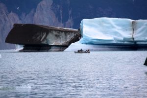
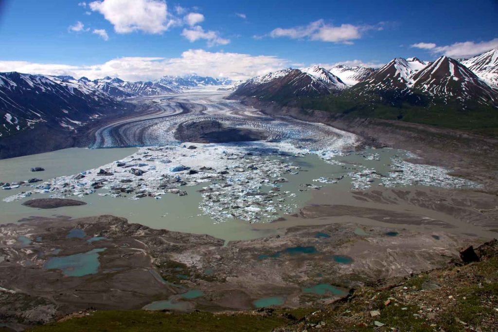
This icy, glacial world, which usually belongs only to a past earth and our imaginations, is the domain of the Alsek. You get a real taste of it about thirty miles downstream from the put-in at Serpentine Creek, where the river enters the lake at the terminus of Lowell Glacier. Lowell has been receding and surging for thousands of years in the typical style of nature’s grand, perpetual rhythms, which are often as bewildering as they are beautiful. Scientists can’t always figure out what provokes a surge—an increased supply of meltwater at the base of the glacier might reduce friction between the ice and the surface it clings to, thermal changes can trigger movement, and poorly consolidated rock may loosen, allowing the ice to abruptly slide forward. These types of events occur deep below the surface ice that we can see, in what is called the “plumbing” of a glacier, inviting images of rusty, creaking pipes in some shadowy space devoted to the mysterious inner workings of a much larger system. In the plumbing system of a glacier, these drainpipes manifest as moulins—deep, tubular chutes, holes, and crevasses that shuttle meltwater across or through the ice, carrying it from our bright, sunlit world into its murky depths. Amidst this cycle of surging and receding, Lowell Glacier is falling apart into the lake, a clamorous process of disintegration known as “calving.” Drifting between and around assorted chunks of ice, it’s as if your boat itself is a piece of the glacier that has broken off into the water. This is a northern dreamscape of exotic whites and blues, foreign sounds and silences, a different species of light unique to this latitude, all of it instilled with the mystique of impossibly long timescales and large distances.
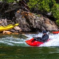
The Alsek exits Lowell Lake as one large channel that quickly becomes spirited whitewater. Most of the major rapids can be found in this stretch of river, which carves a deep, V-shaped canyon into the granitic Alsek Pluton before it opens back up into the Tweedsmuir Glacier Valley. Coastal influence starts to percolate into the ecosystem here—the first Devil’s Club plants appear, a moisture-loving shrub endemic to the rainforests of the Pacific Northwest. About twenty-five miles downstream, the entire volume of the massive Alsek is pinched by the Tweedsmuir Glacier into Turnback Canyon, giving rise to a striking, angry maelstrom of whitewater that explodes downriver through a vise of cliffs. Streams of meltwater from either side of the gorge pour into the boiling, churning froth of river, walled-in by rock like a wild animal in a cage. The water appears to be in complete turmoil. “Horrendous,” Walt Blackadar called this stretch in his journal, “unpaddleable.” Blackadar was the first to take a kayak down Turnback Canyon, a feat that earned him the name of the impressive peak at the canyon’s entrance. It’s difficult to imagine what he must have felt in that alien country, alone in his wetsuit in the darkness, the sound of turbulent, unknown water furiously surging against stone. Only a few groups of expert kayakers have run the infamous stretch of whitewater since Blackadar’s 1971 solo descent. No one else has attempted it alone.
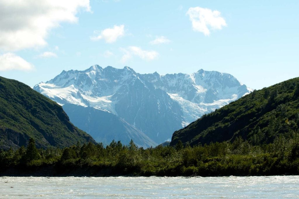
The helicopter portage over Turnback Canyon extracts you from the landscape, lifting you up to witness it from another remarkable perspective. Just as there are unique benefits to floating through this glacial world as part and piece of it, so too are there advantages to observing it from far enough away that the mountains, valleys, and ice can be grasped as an integrated whole. The effect of each facet of this countryside upon and against the others becomes clearer from this distance. Immense, rounded valleys are filled with glaciers that appear to pour down from the peaks, though from up close they appear immobile. From here, you can see that ice truly flows, just as water does, and you can see the way its movement eats away at the earth. Seen from above, the braided rivers and outwash plains at the base of the valleys resemble a surge of spring snowmelt spilling down a dirt road, weaving streams of water sorting out soil and gravel, eventually picking up enough speed and volume to erode deep ruts and potholes—the tiny-scale equivalent of canyons and lakes. Melting glaciers have suspended this region of earth in a prolonged spring. There is a cool freshness to everything, plants are just beginning to emerge, and the currents of water everywhere are young and lively, all of it coursing towards life—more and more complex forms of life. The melt ebbs and flows with the actual yearly seasons, but the trajectory of the thaw is constant.
Back on the water, below Turnback Canyon, the Alsek widens across the outwash plain into braids again, into something so vast it feels more like an ocean than a river. Shorelines are distant, barely visible. Another twenty miles downstream the water builds further, doubling in size at its dramatic confluence with the Tatshenshini. Upstream, the Tat has also been widening with every muscular tributary that empties into it, everything swelling, accelerating, picking up momentum towards the nucleus of the confluence. It is not only rivers that come together here in the valley of the Melburn Glacier; two major faults—the Hubbard and Border Ranges—converge as well, generating all the peculiar, powerful energies that manifest at major fault lines. The Alexander terrane ends and the Chugach terrane begins, a complex assortment of ancient sedimentary and igneous rock butting up against younger, metamorphic and gneissic rock. The theme of intersection in this place extends beyond the rock and river to people. In more recent human history, inland and oceanside cultures encountered one another at the confluence—it is located along an important trade route between coastal Tlingit people and interior Athabascan Indians like the Southern Tutchone.
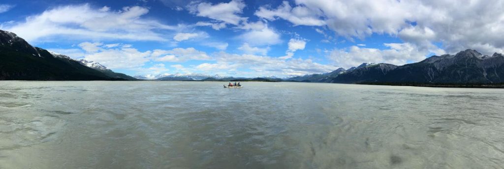
There is an overwhelming potency to this place of convergence, a topographical heart beating where the veins and arteries of the river complex merge and drain. On the largest of several wooded islands near the Tatshenshini delta, there are two petroglyphs that evoke the power of the confluence, power that is at once natural, geologic, geographic, spiritual, and cultural. Each etching is composed of two concentric circles, lines radiating outward like rays of sunlight, a dot in the center. The actual meaning of the petroglyphs is unknown, but it’s easy to imagine they suggest a place from which everything emerges and to which everything returns.
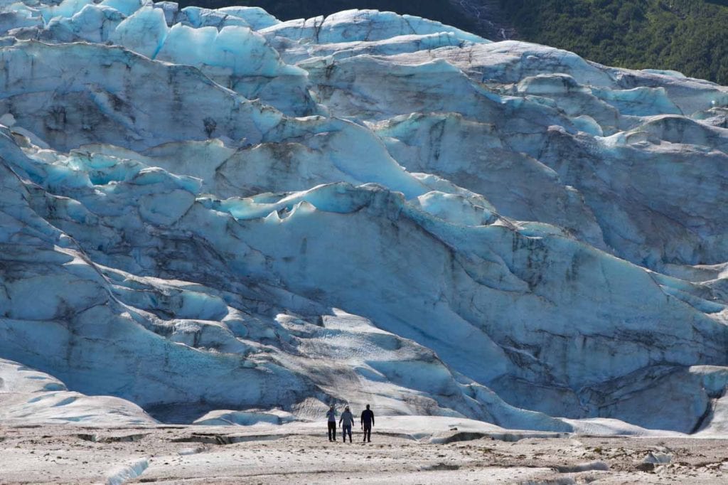
Seventeen miles downriver from the confluence, the Alsek again closes the gap between the present and the Ice Age. If the flow of the river is right, boats can pulled into Walker Lake and rowed across to its namesake glacier, where you can climb out of your boat to explore. Seen up close, all the intricacies of the ice come into focus. If Inuit cultures have hundreds of different words for snow, as the oft-repeated factoid claims, then it seems like cultures living among glaciers must have just as many terms for the shades of blue visible in glacial ice. At times, it appears as if there is an independent source of light shining from within. The crystalline ice, dense from eons of compaction, absorbs every other color of the light spectrum, only reflecting blue. An immeasurable range of densities within the glacier produces the stunning continuum of color, each hue representative of a different age—the older the ice, the richer the blue. Assorted rock debris is embedded everywhere, scraped up from distant places and even more distant times. The stones—ranging from dust and pebble to giant erratic boulder—remain frozen until they are liberated by the melt, deposited into our world like time capsules. Where crevasses intersect, seracs take shape in the glacial architecture, towering like the spires and pinnacles of some immense, Gothic chapel.
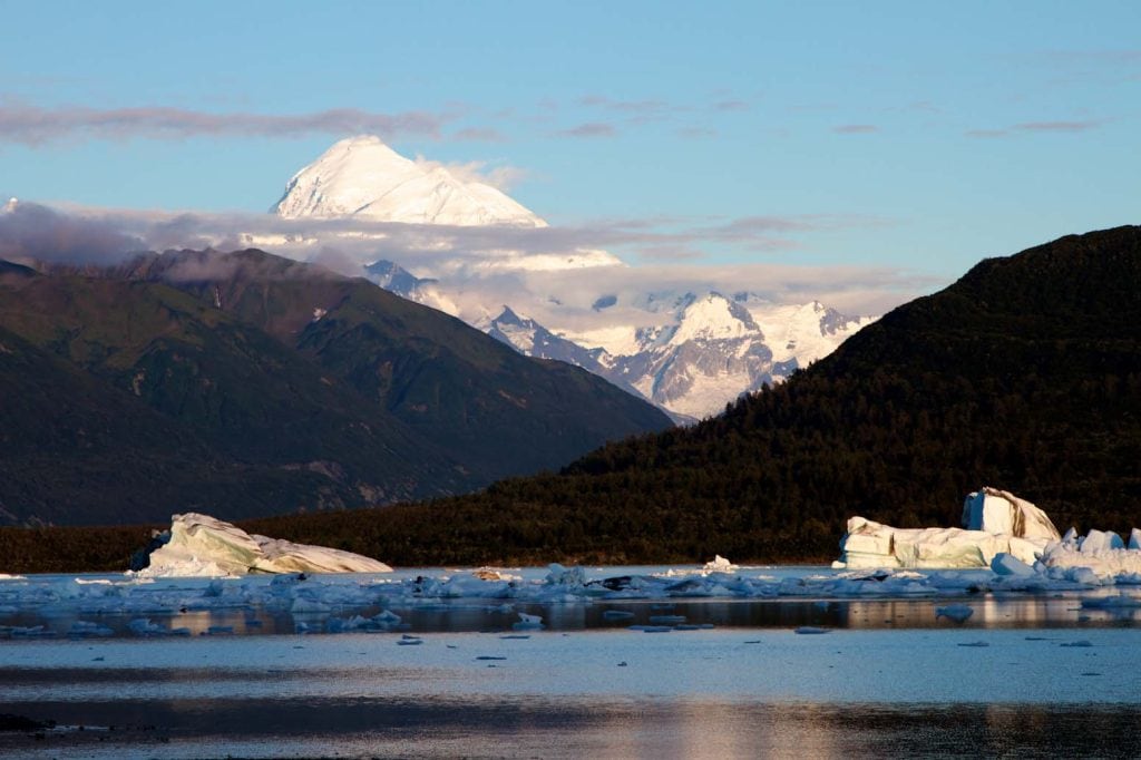
The Alsek leaves Walker as a single channel with a strong, swift current that charges straight towards the Novatak glacier, where it makes its only substantial turn in the twenty-mile stretch to Alsek Lake. The water slowly unravels into braids again as it comes around this solitary bend. Ahead, the corridor is so straight that you can see the terminal moraine of the Alsek glacier, a piece of land known as “the spit.” Indian Paintbrush grows thick on this peninsula, its technicolor blooms thriving in all their radiant mid-summer glory. A series of hanging glaciers adorn the mountain ranges on either side of the river as it approaches the spit, as many as twenty visible from a single vista. The braids of the river, the peaks that bind the valley, the glaciers clinging to the peaks—the most essential quality of each element of the environment here is its mind-blowing size. Floating into Alsek Lake is a fitting grand finale for a trip through a landscape whose most constant, dominant feature is its staggering magnitude. Two monumental glaciers—the Alsek and Grand Plateau—meet to form an eight-mile long shoreline of ice, massive fragments breaking into the frigid, steely blue water. The splashes sound like bombs detonating. Icebergs the size of ships drift around, threatening tidal waves should they tip over or crack in half. Mt. Fairweather dwarfs this otherwise impressive foreground on a clear day, commanding the skyline from more than 15,000 feet, one of the tallest coastal mountains on earth. Beyond its summit, you can sense the frontier of ocean opening up to press against the sky, sweeping out towards a horizon without limits.
Rivers possess a special power in this landscape, not just in the geologic sense, but also for the people that have inhabited it. In the far north, where ice, snow, and stone dominate much of the terrain, life tends to organize itself around the waterways of the lowlands. They are a means of travel, a source of food, a fundamental attribute of the world by which to communicate your bearings. Towards the end of the Ice Age, rivers must have been one of the first indications that this land was transforming, softening into an earthly place more amenable to life. There was undoubtedly some strange and sunny day when the first drop of liquid leaked from the bottom of a glacier. More droplets formed, enough to yield the first small rivulet, which trickled down from the mountains, announcing itself to the frozen, noiseless valley. The Alsek was born. Water would warm and animate the motionless land. Rivulets pooled together to form creeks, creeks became tributaries, tributaries became powerful rivers that spill through the mountains and valleys towards the ocean, fashioning the same landscape they emerged from.
2019 Alsek and Tatshenshini Dates
Upper Alsek July 12th – 23rd – (Book now)
Tatshenshini July 30th – August 9th – (Book now)
Dove Henry grew up roaming the fields and forests of upstate New York. Since graduating from Reed College in 2014, she has worked as a history teacher, waitress, trail builder, wildlife surveyor, maintenance technician, baker, ranch hand, parts runner, and most recently, as a wildland firefighter. When not musing over her next career change or posing as an outdoor recreationist, she can be found working and playing at Lost Trail Ski Area. Dove’s work has been featured in Appalachia Journal, the National Geographic Explorer Blog, ADK Magazine, Montana Quarterly, the essay anthology Wilderness Voices and Idaho Statesman.
